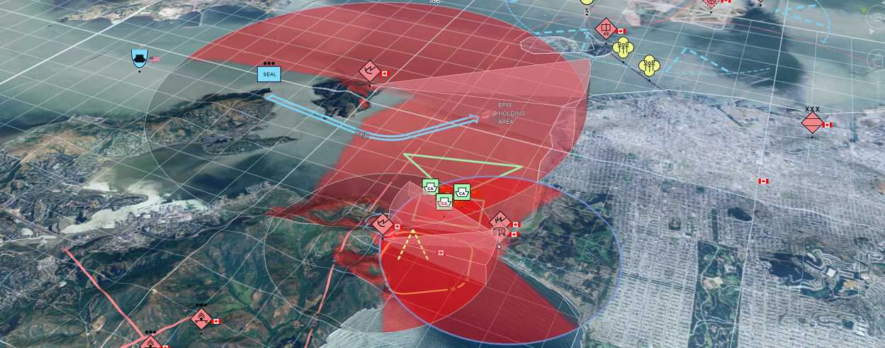
Go beyond conventional GIS to deliver powerful analytics and visualization
While manufacturers’ underlying radar and sonar technologies may be strong and highly performant, today’s users want more than a blipping tracker on a screen. They expect intelligently designed user interfaces (UI), an intuitive user experience (UX), and real-time situational awareness to serve the mission at hand. Typical radar displays as well as conventional GIS systems are ill-equipped to handle the dynamic capabilities and data required.
In this webinar, we will discuss how radar and sonar manufacturers can enhance their systems to deliver a better experience with better information. Through out-of-the-box tools that provide fully customizable capabilities you can enhance your users’ mission-critical operations.
During this webinar, you will learn:
- How to improve radar and sonar planning
- How to fuse multiple data sources for real-time analytics and advanced visualization
- How to support dynamic map displays for tactical use on moving platforms
- How your integration partners can further enhance your systems using a C4ISTAR-focused reusable toolkit
Presenters:
Christoph De Preter - Hexagon
Since 2017, Christoph De Preter has served as the Chief Sales Officer for Hexagon's Geospatial division. Prior to that he was on the Board of Directors and served as the Chief Commercial Officer at Luciad. Christoph is a seasoned professional in the defense, aeronautical and maritime industries. He has a passion for translating technological advances and complex software concepts into customer-oriented benefits.
Igancio Hernández - Hexagon
Ignacio Hernández serves as regional director for Hexagon’s Geospatial division, where he manages a pre-sales team that engages with customers across multiple continents. He holds a bachelor’s degree in Computer Science Engineering and has served in many different roles throughout his 20-year career in the geospatial industry, including developer, consultant, and project manager across different geospatial projects. He joined Hexagon (then Luciad) after six years as a strategic GIS consultant for the Spanish Ministry of Defense and NATO researcher.
![]() This webinar is ideal for radar, sonar, or other sensor manufacturers or systems integrators looking to improve their systems’ performance and deliver even greater value for their customers.
This webinar is ideal for radar, sonar, or other sensor manufacturers or systems integrators looking to improve their systems’ performance and deliver even greater value for their customers.

